Entries from 'Trail'
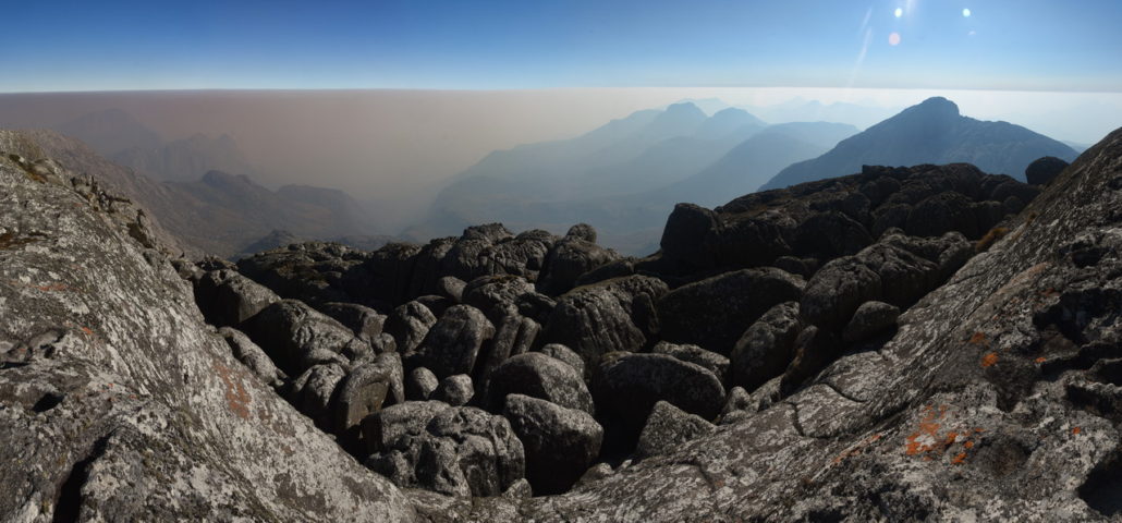
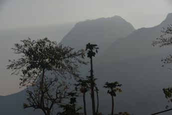
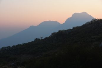
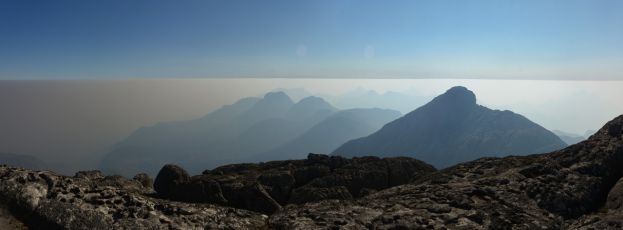
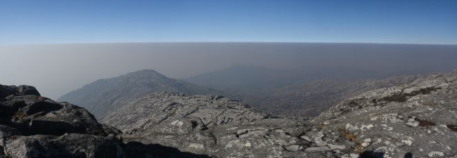
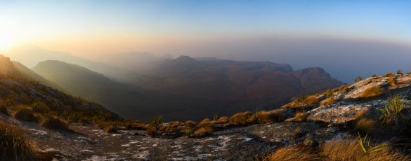
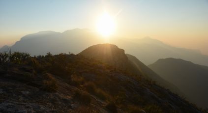
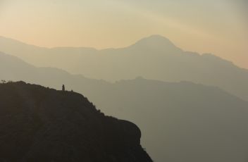
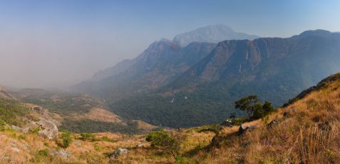
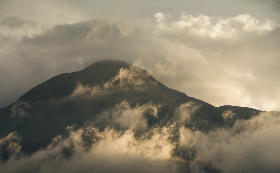
Summit of Malawi, Mt Sapitwa
- Aperture: f/8
- ISO: 200
- Shutter Speed: 1/400 s
- Focal Length: 18mm
- Camera: NIKON D7200

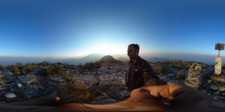
// Nikon D7200 |-15.94856 : 35.59056 | alt. 3002m
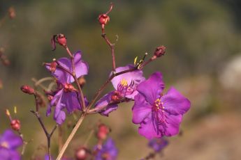
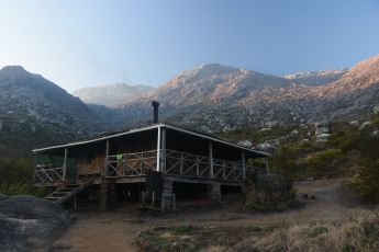
The plan is to drive south of Malawi as far as we can, and then slowly make our way north to Tanzania. So here we are in Likhubula, next to Mulanje, the most popular trail head on the west side of the famous Mulanje massif. A true hikers paradise as we’ve been told, and we stayed at the Hikers nest, about 100m before the gate. Very friendly staff, good kitchen, perfect basecamp to explore the area.
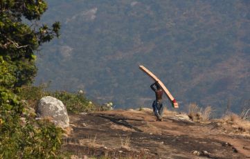
Obviously, as soon as you walk next to the park, dozens of people will join you, offering their services for porters, guides, cooks……… it’s nearly impossible to get rid of them ! And now a classic in Africa, no trail information, no map of the area, nothing, simply impossible to plan a hike properly !
No choice, I had to take a guide. I asked the owner of the campground, and finally found someone to guide me for 2 days up to the highest peak, then I will go solo for an extra 2 days.
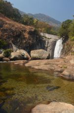
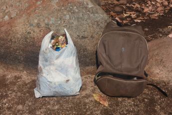
I took an extra day before the trek to prepare my bag carefuly, and then went to the nearest waterfall. I found this lovely spot with a natural swimming pool, pristine water, and a large waterfall in the back ! This place would be paradise…….. if it wasn’t covered with trash… It was so disgusting I had to clean it.
It took me a good hour, and on the way back, I was surprised by the reaction of the locals : some were upset because I went in the park without a guide, some said I was trying to sneak in the park without paying park fee (which I paid for) but eventually some would say thank you for cleaning their mess…..
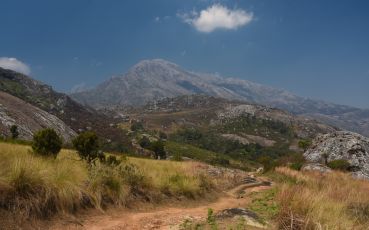
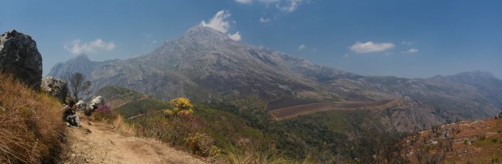
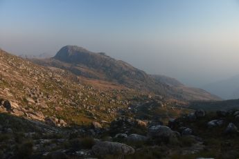
Time to hike this mountain, going for the skyline route up to Chambe hut, then Chisepo hut, climbing Sapitwa and Chilembe on the second day, and come back on the third day.
My guide Steven is young, 23yo, knows all the trails, but still lacks experience in terms of guiding people and having a proper walking pace….. I guess he wanted to show off, and started walking as fast as he could, but he picked the wrong tourist for that, and then, running out of energy, he had to make a lot of small stops to recover. He also didn’t tell me where are the water points on the way, and his estimation for walking distances and time were completely off and useless…… Water ended up to be a problem.
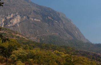
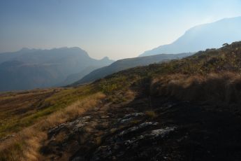
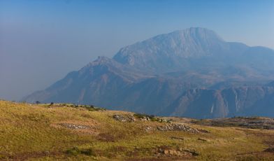
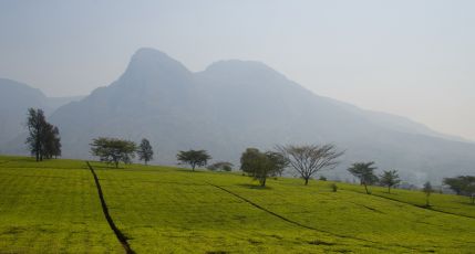
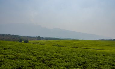
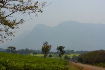
Mulanje massif is a national reserve, like a national park, with only a very small park fee. Sadly, this doesn’t prevent people from chopping all the trees, in fact, they are chopping all the trees of the country ! There is almost nothing left, even with reforestation programs, and cutting wood now being illegal….. Like other African countries, they are short sighted and just don’t care about their country. So with the lack of trees on the mountain, the water doesn’t go inside the soil providing drinking water, and instead, it will wash the ground, removing what’s left of this unique ecosystem. Believe it or not, the plateau on top of Mulanje used to be a jungle with an incredible birdlife. Everything’s gone now……
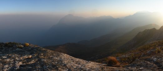
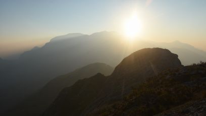
On top of that, this is the season where people are burning their fields, not just in Malawi, but everywhere ! The amount of smoke is so intense you cannot see further than a few kilometers. Big disappointment after climbing the highest peak of Malawi, Mt Sapitwa, I could not even see the plateau, and a dense layer of smoke was rolling over the entire landscape….. Even Paris on a very polluted day looks far better than this !
So went up to Sapitwa, then up to Chilembe, a fairly physical hike, and I could tell my performance went down after all this time sitting behind the wheel. This place must be fantastic during the good season (april to end of july) but even without pollution, looking at the locals destroying this beautiful place is shocking.
Back to Hikers nest, after the usual laundry and cleaning job, it was a good time to socialize with people passing by, always great experiences with travelers.
Copacabana
- Aperture: f/8
- ISO: 160
- Shutter Speed: 1/800 s
- Focal Length: 10.5mm
- Camera: NIKON D5000
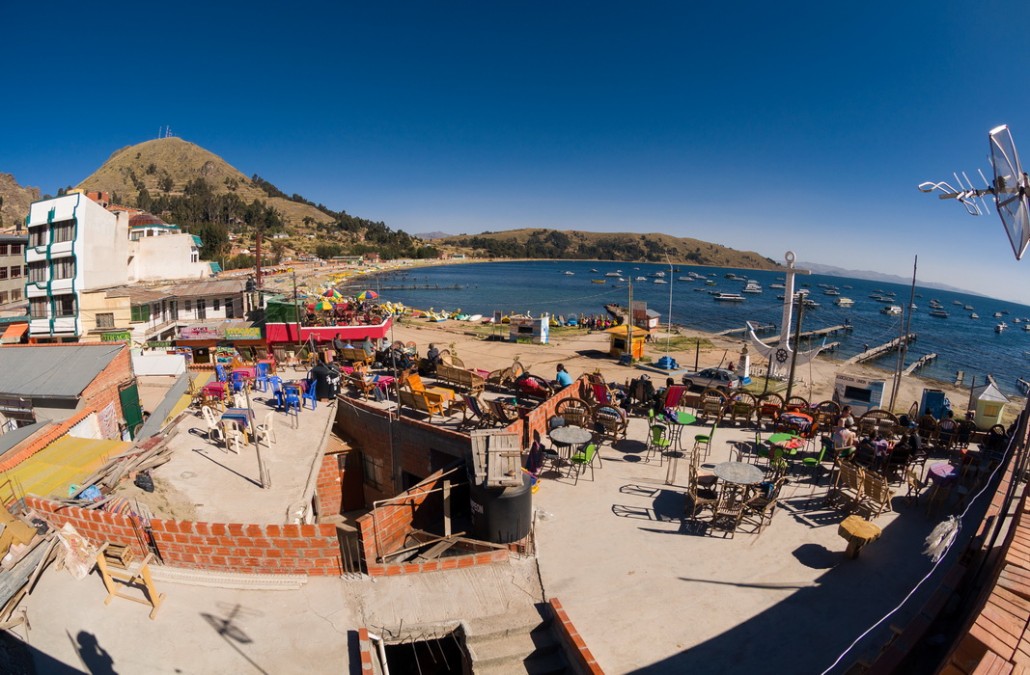
// Nikon D5000, nikon 18-200 | -16.16735 : -69.0883 | alt. 3840m Au petit matin, nous arrivons a la frontiere du Perou. Le piege est deja en place….. Devant nous, une chaine tendue bloque l’acces, mais 10m avant, une autre chaine est au sol. Entre les 2, les batiments de la douane…
Santa Cruz trek
- Aperture: f/8
- ISO: 100
- Shutter Speed: 1/200 s
- Focal Length: 12mm
- Camera: NIKON D7000
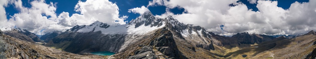
// Nikon D7000, nikon 18-200, nikon 50, tokina 12-24 Nous voici embarques pour le celebre Santa Cruz, un trek de 3 jours a travers la cordillera blanca ! La plupart des gens le font avec un guide, un cuistot, et toute une ribambelle d’anes pour porter les affaires, mais nous le faisons en parfaite autonomie….
Lago Paron
- Aperture: f/6.3
- ISO: 320
- Shutter Speed: 30 s
- Focal Length: 50mm
- Camera: NIKON D7000
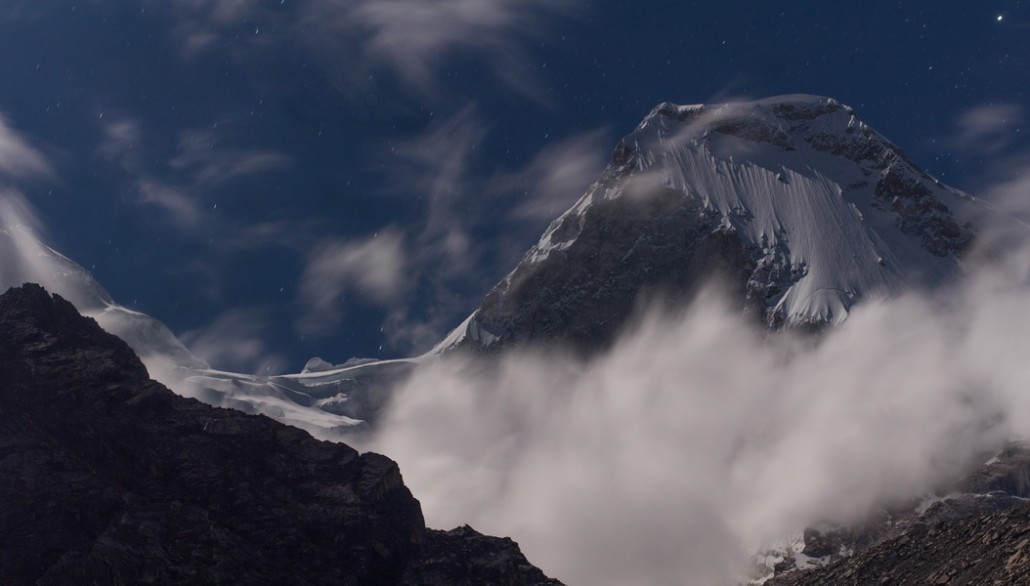
[audio:http://le-voyage.eu/wp-content/uploads/2015/06/2014-05-14-lago-paron-oiseaux.mp3|autostart=yes|loop=yes | titles= birds near lago Paron] // Nikon D7000, nikon 18-200, nikon 50, tokina 12-24 | -9.04173 : -77.8118 | alt. 2322m D’autres voyageurs nous avaient recommande cet endroit, et c’est reellement sublime ! Une courte marche permet d’aller de l’autre cote du lac, afin d’apercevoir d’autres sommets, mais nous ne…
Cajas national park
- Aperture: f/8
- ISO: 200
- Shutter Speed: 1/200 s
- Focal Length: 14mm
- Camera: NIKON D5000
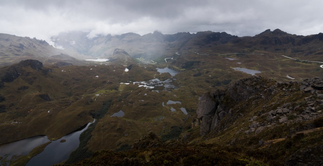
[audio:http://le-voyage.eu/wp-content/uploads/2015/05/2014-05-03-nuit-Cajas-national-parc.mp3|autostart=yes|loop=yes | titles= nuit dans le parc Cajas] // Nikon D5000, nikon 50, tokina 12-24 | -2.84461 : -79.14198 | alt. 3160m On commence par la partie basse du parc, a l’est, pour faire le tour du lac. On fait juste une photo et nous repartons, rien de plus a voir !…
Le plus beau des levers de soleil, Cayambe
- Aperture: f/5
- ISO: 640
- Shutter Speed: 1/30 s
- Focal Length: 19mm
- Camera: NIKON D7000

// Nikon D7000, nikon 50, tokina 12-24 | 0.00768 : -78.02183 | alt. 4356m Nous sommes a 4500m d’altitude, et en prevision du froid, nous avons calfeutre toutes les fenetres et mis les panneaux isolants. Apres l’experience a El Cocuy en altitude, nous laissons le toit ouvrant ouvert pour faire entrer un…
Ascension de l’Imbabura (4630m)
- Aperture: f/8
- ISO: 250
- Shutter Speed: 1/640 s
- Focal Length: 95mm
- Camera: NIKON D7000
[audio:http://le-voyage.eu/wp-content/uploads/2015/03/2014-03-18-Imbabura.mp3|autostart=yes|loop=yes | titles= Vent au sommet de l’Imbabura] // Nikon D7000, nikon 18-200 | 0.30684 : -78.13206 | alt. 2444 m Nous passons de super bons moments avec Graham avec qui nous avons sympathiser, et nous nous baladons souvent avec lui pour decouvrir les environs (le lago de Cuicocha) et pour rentrer…
Fin del Mundo
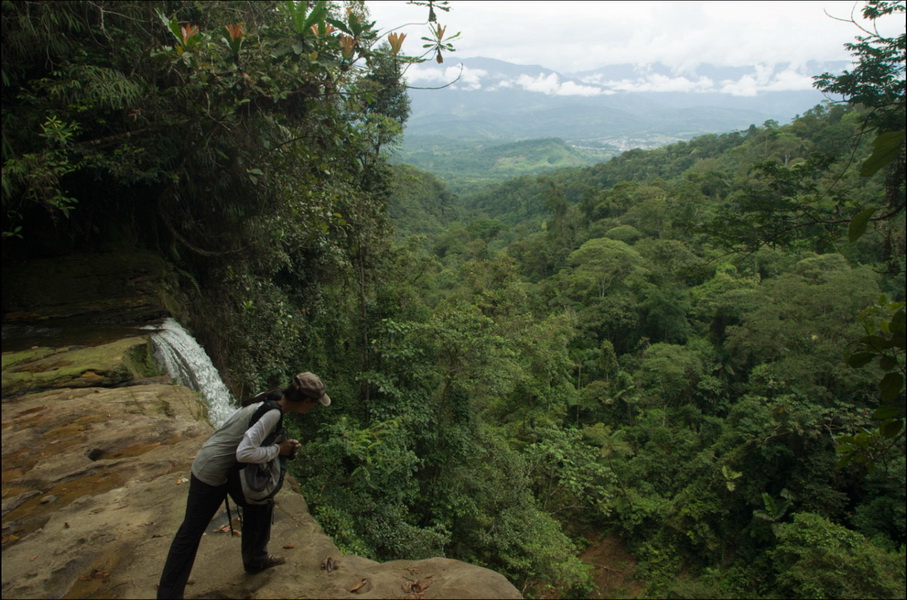
[audio:http://le-voyage.eu/wp-content/uploads/2015/03/2014-03-10-Fin-del-mundo.mp3|autostart=yes|loop=yes | titles= refuge animalier pres de Mocoa] // Nikon D7000, nikon 18-200 | 01.12429 : -76.63844 | alt. 535m Voila, nous sommes deja sur la route pour partir a l’ouest vers Popayan, et bientot la frontiere de l’Equateur. Mais seulement 130kms au sud se trouve la petite ville de Mocoa, porte…
Tierradentro
- Aperture: f/3.2
- ISO: 1000
- Shutter Speed: 1/6 s
- Focal Length: 10.5mm
- Camera: NIKON D7000
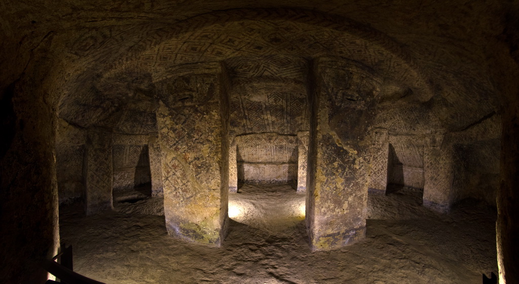
[audio:http://le-voyage.eu/wp-content/uploads/2015/03/2014-03-07Tierradentro-vallee.mp3|autostart=yes|loop=yes | titles= Vallee de Tierradentro] // Nikon D7000, nikon 18-200 | 02.46385 : -75.71144 | alt. 818m Une fois passee la porte de Tierradentro, c’est avec surprise que nous voyons une carte du site avec les chemins de randonnee ! Le musee est bien ici, mais les sites sont eparpilles dans…
Vallee de Cocora
- Aperture: f/8
- ISO: 400
- Shutter Speed: 1/640 s
- Focal Length: 65mm
- Camera: NIKON D7000
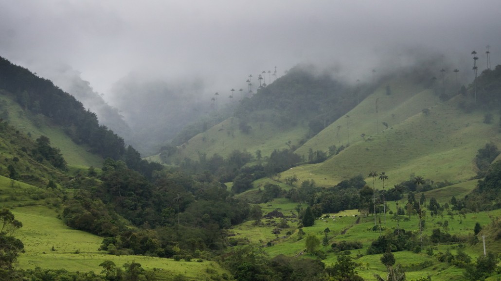
[audio:http://le-voyage.eu/wp-content/uploads/2015/02/2014-03-04-Vallee-de-Cocora_2.mp3|autostart=yes|loop=yes | titles= Vallee de Cocora] // Nikon D7000, nikon 18-200, sigma 120-400 | 4.63766 : -75.48721 | alt. 2427 m Nous arrivons en fin de journee a l’entree de la vallee de Cocora. Forcement, en descendant a basse altitude, nous nous retrouvons dans les nuages et une tres legere pluie….